How to create a cut and fill map
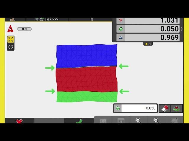
A new function in iCON site with version 7.0, is the cut/fill map. See how easy this is to map a surface and then even the material to the calculated balanced site elevation.
(Leica Geosystems Machine Control Academy project ID 105IA)
(Leica Geosystems Machine Control Academy project ID 105IA)
Тэги:
##DirtSimple ##LeicaGeosystems ##LeicaiCONsite ##MachineControl ##SitePreparation ##WhenItHasToBeRightКомментарии:
How to create a cut and fill map
Leica Geosystems AG
I Stole EVERY Players Head.
ManePear
O | Romanian Alphabet Lore | NJsaurus
NJsaurus AUTTP ATHDTC ATSPL
MAKING OF - GATINHA TÃO LINDA | TIM BOY
Tim Boy Oficial
Lee Brice - Boy (Official Music Video)
Lee Brice
Beautiful Boy - Official Trailer | Amazon Studios
Prime Movies





![How does CATNAP TRANSFORM? (hacking behind him) - Poppy Playtime [Chapter 3] Secrets Showcase How does CATNAP TRANSFORM? (hacking behind him) - Poppy Playtime [Chapter 3] Secrets Showcase](https://rtube.cc/img/upload/QXdHNXB0RzdrTkM.jpg)


